Description:
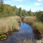
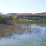
Lake Charlevoix collects water from a 214,400-acre Watershed. The Lake Charlevoix Watershed is predominantly forested. Lake Charlevoix Watershed includes: Lake Charlevoix, the Jordan River, Boyne River, Stover Creek, Horton Creek, Loeb Creek, Deer Creek, Porter Creek, and Monroe Creek. Beech/maple, white pine, and other upland forest account for just over 50% of the land in the Watershed. Wetlands are estimated to account for 22% of land use. Agricultural uses occupy approximately 15% of the land. The urban areas of Boyne City, Boyne Falls, Charlevoix, and East Jordan account for approximately 4% of the land use in the Watershed. The remaining 9% consists of water and other miscellaneous uses. Although this Watershed is still predominantly forested, development is occurring at a rapid pace reducing the amount of forests, agricultural lands, and wetlands.
To Read More About the Lake Charlevoix Watershed, Follow the Story Map Below
Geographic Description:
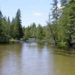
The Lake Charlevoix Watershed is one of Northern Michigan’s larger watersheds covering approximately 332 square miles or 212,515 acres in Antrim, Charlevoix, Emmet, and Otsego Counties. The majority of Charlevoix County’s townships are in the watershed including: Bay, Boyne Valley, Charlevoix, Eveline, Evangeline, Hayes, Hudson, Marion, Melrose, South Arm, and Wilson. Antrim County townships in the Watershed include: Chestonia, Echo, Jordan, Star, and Warner. A portion of Elmira Township in Otsego County and a part of Resort Township in Emmet County are also a part of the Watershed. The Lake Charlevoix Watershed includes the municipalities of Charlevoix, Boyne City, East Jordan, and Boyne Falls. The unincorporated villages of Alba, Bay Shore, and Elmira are also in the Watershed. Lake Charlevoix stretches across the west side of Charlevoix County from northwest to southeast, covering portions of seven townships (Bay, Charlevoix, Evangeline, Eveline, Hayes, South Arm, and Wilson) and touching upon three municipalities (Boyne City, City of Charlevoix, and City of East Jordan).
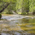
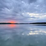
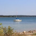
The lake has two distinct arms separated by an expansive peninsula-like land form. The main basin of Lake Charlevoix measures nearly 14 miles from the entrance to Round Lake at the west end to Boyne City on the east end, and ranges from one to two miles in width. The South Arm extends over 8 miles from Hemingway Point on the main basin southward to East Jordan, and is narrower with widths of less than one mile. Round Lake connects Lake Charlevoix to the Pine River, is encircled by the City of Charlevoix, and measures a half mile or less in diameter. The Pine River measures slightly less than one mile in length and is approximately 110 feet wide and 18 feet deep. The Pine River is a heavily-trafficked waterway because it provides passage between Lake Charlevoix and Lake Michigan. Accordingly, the River requires periodic dredging on a 10 to 15 year cycle, although the last dredge was in 1984. Flow through the channel is interchangeable and may be attributed to seiches, or wind-driven waves, occurring on Lake Michigan; however, the River typically flows toward Lake Michigan.
Lake Charlevoix Water Quality and Pollution
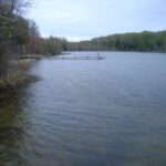
The water quality of Lake Charlevoix and its tributaries is currently good. Maintaining the good water quality (or improving it) requires ensuring activities in the Watershed don’t contribute pollutants that can harm water quality. In an effort to reduce nonpoint source pollution, the Lake Charlevoix Watershed Project is focused on maintaining the following components of water quality:
- Recreational Quality Support high water quality to encourage all forms of recreation – swimming, boating, and fishing – by reducing inputs of sediment, nutrients, and bacteria.
- Fishery Quality Sustain an excellent cold water fishery by reducing sediment and nutrient loads that can threaten fish habitat and result in higher water temperatures in the lake and its river tributaries.
- Habitat Quality Protect Watershed biodiversity by protecting vital aquatic plant and animal habitats from pollution.
- Navigational Quality Maintain lake and river tributary navigation by promoting methods to reduce all means of sediment input.
Lake Charlevoix Nonpoint Source Pollution Inventories Summary
Understanding which land use activities are contributing the most nutrient and sediment pollution to Lake Charlevoix and its tributaries is essential for determining how we can best protect our valuable Lake and rivers.
Nonpoint Source Pollution Inventories
- Stormwater
- Shoreline Pollution
- Lakeshore Erosion
- Streambank Erosion
- Road/Stream Crossing
- Recreational Impact Assessment Agriculture
- Sensitive Areas Assessment
- Forestry
- Land Use/Cover Type
- Zoning
- Build-out Analysis
Inventories completed and ongoing as part of the current Lake Charlevoix Watershed Project have surveyed a variety of land use activities contributing nonpoint source pollution to the lake and its tributaries. Preliminary results reveal sediment contributions form road/stream crossings, shoreline activities, and recreational uses on the rivers. Stormwater discharges in the urban areas, shoreline practices, and agricultural activities have been identified as sources of nutrient pollution.
Reducing the amount of nonpoint source pollution and preventing future contributions to Lake Charlevoix is essential to protecting the many high quality uses this resource provides including swimming, boating, and fishing. The proposal implementation activities for the Lake Charlevoix Watershed Project will work towards this goal.
Recommended Actions to use land use tools to reduce nonpoint source pollution
- Develop model zoning standards for the Watershed with basic definitions and standards to setbacks, greenbelts, conservation planning, redevelopment of shoreline properties, and other similar measures to reduce pollution.
- Implement ongoing education program for local governments on land use planning tools that can help protect water quality and encourage better coordination among neighboring townships Identify nonconforming lots on lakeshore and work with townships to discuss potential water quality impacts and solutions.
- Assess septic inspection programs and septic maintenance districts and consider adopting for the Watershed.
- Document the existing greenbelts on the lakeshore to encourage better enforcement of greenbelt regulations.
- Develop a yearly summary of variances of sanitary code/zoning to determine if there are water quality impacts.
- Educate Watershed residents, including students, about land use issues and foster citazen involvement in local land use decision making.
- Publish a handout/brochure that lists information on permits needed and who to contact when building
- Sponsor education program for lake/river realtors on special regulations and management for riparian properties.
- Disseminate results of land use survey and build-out analysis to local governments in the Watershed.
- Create incentives for developers to utilize conservation design plans developed for properties.
- Meet with local golf course managers and discuss management techniques to reduce nonpoint source pollution.
Lake Charlevoix Watershed Project Partners:
|
Funding for the Lake Charlevoix Watershed Project was provided by Michigan Department of Environmental Quality.