fbpx
Search
Close this search box.
Protecting Northern Michigan's ​Water Resources

Lake Bellaire

Formerly known as Grass Lake, Lake Bellaire is located southwest of the town of Bellaire in Antrim County. Lake Bellaire is a deep lake surrounded by extensive and ecologically important wetlands.

1,789 acres

OF SURFACE AREA

12 miles

OF SHORELINE

95 feet

MAX DEPTH

Overview of Lake Bellaire

Primary Inflows

Headwaters

Primary Outflows

Surface Area

1,789 acres

Shoreline

12 miles

Maximum Depth

95 feet

Known Aquatic Invasive Species

Description:

Formerly known as Grass Lake, Lake Bellaire is located southwest of the town of Bellaire in Antrim County. Major inlet tributaries include the Intermediate River, which drains the upper Chain of Lakes through Bellaire, and Grass Creek, which flows into the north end of the North Arm. Water leaving Lake Bellaire flows through the Grass River into Clam Lake and eventually into Lake Michigan at the Village of Elk Rapids on East Grand Traverse Bay. 

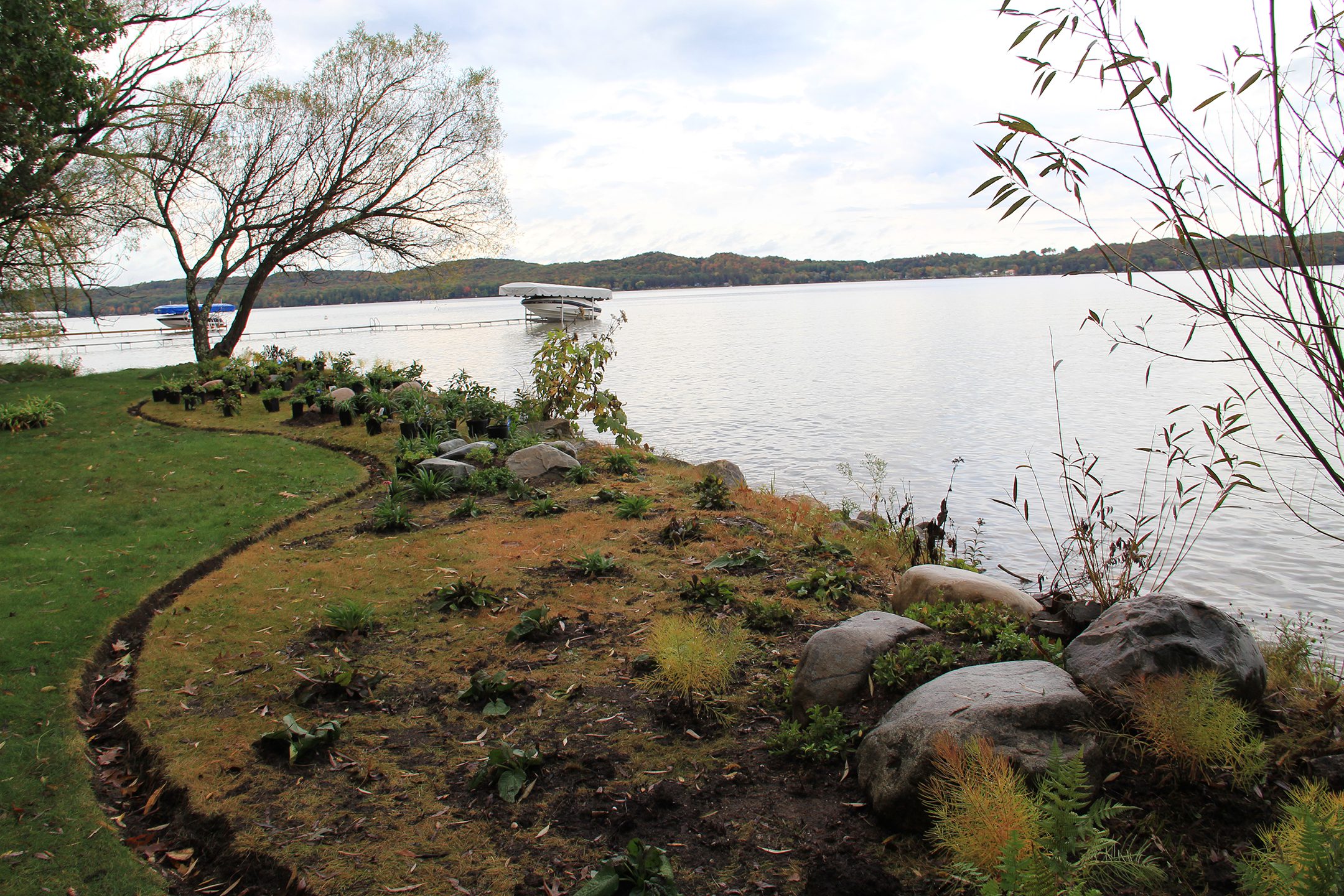
Lake Bellaire is a deep lake surrounded by extensive and ecologically important wetlands. These include conifer or mixed hardwood/conifer swamps on the north end, marshy areas west of the mouth of the Intermediate River, and marshy and swampy areas on the south end. Along with their ability to filter pollutants in the water, wetlands provide habitat to amphibians, mammals, birds, trees, flowers, and other forms of life.

There are virtually no natural rocky shorelines on Lake Bellaire, which is unusual for a lake of this size in the Elk River Watershed. This has been identified as a potential problem for successful spawning of some fish species. Most of the nearshore sediments in Lake Bellaire consist of sand or gravelly-sand. The remainder, largely in the north arm, consists of  muck or marl-sand bottom.

Muskgrass (Chara spp) is a common ‘plant’ found in the nearshore areas of Lake Bellaire. Actually a multicellular branching green algae, muskgrass gets its name from its “musky” smell.

Like to fish? Because the deep water of Lake Bellaire remains cold and oxygen-rich during summer months, the lake is able to support a cold water fishery. Warm water fish inhabit shallower areas. Fish that have been found in Lake Bellaire include whitefish, perch, herring, northern pike, rock bass, smallmouth bass, largemouth bass, bluegill, lake trout, longnose gar, white sucker, brook silverside, blunt nose minnow, walleye, brook trout, black crappie, yellow perch, white sucker, brown trout, splake, pumpkinseed, brown bullhead, cisco, smelt, and rainbow trout.

Monitoring and Research:

Lake Bellaire is monitored every three years through the Watershed Council’s Comprehensive Water Quality Monitoring (CWQM) Program for dissolved oxygen, specific conductivity, pH, nitrate-nitrogen, total nitrogen, total phosphorus, and chloride levels.

This lake is monitored through the State’s Cooperative Lakes Monitoring Program (CLMP).

The Elk River Chain of Lakes Watershed Plan Implementation Team meets regularly and is working to protect the lakes in the Chain.

Three Lakes Association
The mission of the Three Lakes Association is to provide leadership to preserve, protect, and improve the environmental quality of the Elk River Chain of Lakes Watershed for all generations with emphasis on Lake Bellaire, Clam Lake, Torch Lake and their tributaries.
P.O. Box 689, Bellaire, Michigan, 49615
231-412-7551

Additional Resources:

View an interactive map of Lake Bellaire, including public access sites, on Michigan Fishweb. Please note this link will take you away from the Tip of the Mitt Watershed Council site. 
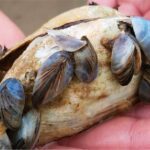
TitleCategoriesLinkhf:doc_categories
Comprehensive Water Quality Monitoring (CWQM)Bass Lake, Beals Lake, Bear River, Ben-Way Lake, Birch Lake, Black Lake, Black Lake Watershed, Black River, Boyne River, Burt Lake, Burt Lake Watershed, Carp River Watershed, Cheboygan River, Cheboygan River Watershed, Clam Lake, Crooked Lake, Crooked River, Deer Lake, Douglas Lake, Duncan-Grass Bay Watershed, Elk Lake, Elk River, Elk River Chain Of Lakes, Elk River Chain of Lakes Watershed, Ellsworth Lake, Grand Traverse Bay Watershed, Hanley Lake, Huffman Lake, Intermediate Lake, Lake Bellaire, Lake Charlevoix, Lake Charlevoix Watershed, Lancaster Lake, Larks Lake, Little Traverse Bay Watershed, Long Lake, Marion Lake, Mud Lake, Mullett Lake, Mullett Lake Watershed, Munro Lake, Nowland Lake, Paradise Lake, Pickerel-Crooked Lakes Watershed, Round Lake, Scotts Lake, Silver Lake, Six Mile Lake, Skegemog Lake, Spring Lake, St. Clair Lake, Susan Lake, Thayer Lake, Thumb Lake, Torch Lake, Twin Lake, Walloon Lake, Walloon Lake Watershed, Wildwood Lake, Wilson Lakebass-lake beals-lake bear-river ben-way-lake birch-lake black-lake black-lake-watershed black-river boyne-river burt burt-lake-watershed carp-river-watershed cheboygan-river-rivers-streams cheboygan-river-watershed clam-lake crooked-lake crooked-river deer-lake douglas-lake duncan-grass-bay-watershed elk-lake elk-river elk-river-chain-of-lakes elk-river-chain-of-lakes-watershed ellsworth-lake grand-traverse-bay-watershed hanley-lake huffman-lake intermediate-lake lake-bellaire lake-charlevoix lake-charlevoix-watershed lancaster-lake larks-lake little-traverse-bay-watershed long-lake marion-lake mud-lake mullett-lake mullett-lake-watershed munro-lake nowland-lake paradise-lake pickerel-crooked-lakes-watershed round-lake scotts-lake silver-lake six-mile-lake skegemog-lake spring-lake st-clair-lake susan-lake thayer-lake thumb-lake torch-lake twin-lake walloon-lake walloon-lake-watershed wildwood-lake wilson-lake inland-lakes rivers-streams watersheds
2022 Elk River Chain of Lakes Watershed Management PlanBeals Lake, Ben-Way Lake, Clam Lake, EGLE/EPA Approved Watershed Management Plans, Elk Lake, Elk River, Elk River Chain of Lakes Watershed, Ellsworth Lake, Hanley Lake, Intermediate Lake, Lake Bellaire, Scotts Lake, Six Mile Lake, Skegemog Lake, St. Clair Lake, Torch Lake, Wilson Lakebeals-lake ben-way-lake clam-lake watershed-plan-approved elk-lake elk-river elk-river-chain-of-lakes-watershed ellsworth-lake hanley-lake intermediate-lake lake-bellaire scotts-lake six-mile-lake skegemog-lake st-clair-lake torch-lake wilson-lake inland-lakes rivers-streams watersheds
2017 Lake Bellaire Shoreline SurveyElk River Chain Of Lakes, Lake Bellaire, Shoreline Surveyselk-river-chain-of-lakes lake-bellaire shoreline-surveys inland-lakes
2014-2015 Elk River Invasive Species Monitoring Project ReportBeals Lake, Ben-Way Lake, Clam Lake, Elk Lake, Elk River, Elk River Chain of Lakes Watershed, Ellsworth Lake, Hanley Lake, Intermediate Lake, Invasive Species Monitoring, Lake Bellaire, Scotts Lake, Six Mile Lake, Skegemog Lake, St. Clair Lake, Torch Lake, Wilson Lakebeals-lake ben-way-lake clam-lake elk-lake elk-river elk-river-chain-of-lakes-watershed ellsworth-lake hanley-lake intermediate-lake invasive-species-monitoring lake-bellaire scotts-lake six-mile-lake skegemog-lake st-clair-lake torch-lake wilson-lake inland-lakes rivers-streams watersheds
2013 Lake Bellaire and Clam Lake Aquatic Plant SurveyAquatic Plant Surveys, Clam Lake, Lake Bellaireaquatic-plant-surveys clam-lake lake-bellaire inland-lakes
2010 Lake Bellaire, Clam Lake, Torch Lake Shoreline Algal SurveyClam Lake, Lake Bellaire, Torch Lakeclam-lake lake-bellaire torch-lake inland-lakes

Shoreline Survey:

Elk River Chain of Lakes Shoreline Survey

Project Summary During the summers of 2016 and 2017, the Tip of the Mitt Watershed Council led a coordinated effort to conduct a shoreline survey for 15 Lakes in the Elk River Chain of Lakes Watershed. The surveys were meant to document conditions that could impact water quality, including the

View GIS Map »

Media Gallery: