
Monitoring and Research:
Walloon Lake is monitored every three years through the Watershed Council’s Comprehensive Water Quality Monitoring (CWQM) Program for dissolved oxygen, specific conductivity, pH, nitrate-nitrogen, total nitrogen, total phosphorus, and chloride levels.
Water transparency, chlorophyll-a, and water temperature are also monitored in Walloon Lake each summer by volunteers as part of the Watershed Council’s Volunteer Lake Monitoring (VLM) Program.
The Advisory Committee of the Little Traverse Bay Watershed Protection Plan is working to protect Walloon Lake, as its water drains into Little Traverse Bay.
Description:
Walloon Lake’s rolling glacial terrain surrounds its deep waters, including its five distinct depressions or basins:
- Foot – 94 ft.
- Mud Lake – 14 ft.
- West Arm – 100 ft.
- North Arm – 52 ft.
- Wildwood – 80 ft.
The lake and its watershed are located in Bay, Evangeline, and Melrose townships of Charlevoix County; and Bear Creek and Resort Townships of Emmet County. The lake has a relatively small watershed (22,650 acres) compared to its lake surface area (4,270 acres). Five percent of the Walloon Lake Watershed is classified as wetlands. Of particular importance is the North Arm’s wetland complex, where over 5,000 acres of the land drain through the wetlands before reaching the waters of the North Arm.
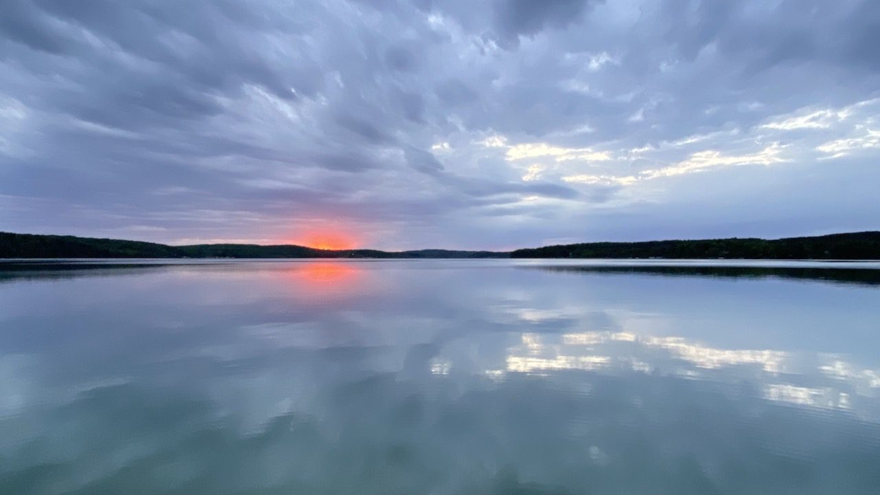
Walloon Lake is primarily fed by groundwater (53%) and only has a few small inlet creeks, Schoof’s Creek, and Fineout. Walloon Lake is characterized as an oligotrophic lake. It has low plant growth and algae, high water clarity, and is generally cold and deep. The lake supports populations of walleye, smallmouth bass, northern pike, rock bass, perch, and stocked rainbow and lake trout.
Water Quality
Since the turn of the century, Walloon Lake has attracted development. Its irregular shoreline results in a high (3.0) shoreline development factor (i.e., the ratio of shoreline length [27.5 miles] to lake surface area). This means the lake is more susceptible to pollution from shoreline activity (development, erosion, fertilizer use, etc.) than a lake that is rounder. The lake, however, has managed to maintain its excellent water quality despite pressures and impacts from increasing shoreline development. While several features, including the lake’s depth, the presence of marl (a type of soil that contains calcium carbonate and clay), and its small watershed size enhance the lake’s ability to buffer its waters from the detrimental effects of development, the lake is not unaffected. The irregular shoreline of Walloon Lake and its long retention period (4.1 years) make it particularly sensitive to nutrient additions from development.
Lake Pollution
The majority of pollutants entering the lake are nutrients, primarily phosphorus, sediment from nonpoint sources, such as runoff from fields and roads, and leachate from failing septic systems. With over 830 dwellings along its shoreline, many aging septic systems contribute wastewater seepage directly into the lake. In addition, many of the shoreline soils do not adequately remove nutrients from septic system effluent.
Wetlands
Wetlands provide various important ecological services that contribute to the health of Walloon Lake and other surface waters in the Watershed, including fish and wildlife habitat, water quality protection, flood control, and erosion prevention. Walloon Lake has five large wetland complexes: Schoof’s Creek, Jones Landing, Mud Lake, Lily Pad Bay, and South Arm Creek. These wetlands are all detailed in the “Walloon Lake Wetlands and Tributaries Assessment 2012” in Reports and Studies.

Additional Resources:
See additional resources on our Aquavist page.
View an interactive map, including public access sites, at Michigan Fishweb.
A wide variety of maps for this area are available online at the Michigan Natural Features Inventory (MNFI) Data Resources page.
Information about Threatened, Endangered, and Special Concern species in this lake’s watershed is available on the Michigan Natural Features Inventory (MNFI) website.
Learn about safely eating fish from this lake in the Michigan Fish Consumption Advisory.
| Title | Categories | Link | hf:doc_categories |
|---|---|---|---|
| Comprehensive Water Quality Monitoring (CWQM) | Bass Lake, Beals Lake, Bear River, Ben-Way Lake, Birch Lake, Black Lake, Black Lake Watershed, Black River, Boyne River, Burt Lake, Burt Lake Watershed, Carp River Watershed, Cheboygan River, Cheboygan River Watershed, Clam Lake, Crooked Lake, Crooked River, Deer Lake, Douglas Lake, Duncan-Grass Bay Watershed, Elk Lake, Elk River, Elk River Chain Of Lakes, Elk River Chain of Lakes Watershed, Ellsworth Lake, Grand Traverse Bay Watershed, Hanley Lake, Huffman Lake, Intermediate Lake, Lake Bellaire, Lake Charlevoix, Lake Charlevoix Watershed, Lancaster Lake, Larks Lake, Little Traverse Bay Watershed, Long Lake, Marion Lake, Mud Lake, Mullett Lake, Mullett Lake Watershed, Munro Lake, Nowland Lake, Paradise Lake, Pickerel-Crooked Lakes Watershed, Round Lake, Scotts Lake, Silver Lake, Six Mile Lake, Skegemog Lake, Spring Lake, St. Clair Lake, Susan Lake, Thayer Lake, Thumb Lake, Torch Lake, Twin Lake, Walloon Lake, Walloon Lake Watershed, Wildwood Lake, Wilson Lake | bass-lake beals-lake bear-river ben-way-lake birch-lake black-lake black-lake-watershed black-river boyne-river burt burt-lake-watershed carp-river-watershed cheboygan-river-rivers-streams cheboygan-river-watershed clam-lake crooked-lake crooked-river deer-lake douglas-lake duncan-grass-bay-watershed elk-lake elk-river elk-river-chain-of-lakes elk-river-chain-of-lakes-watershed ellsworth-lake grand-traverse-bay-watershed hanley-lake huffman-lake intermediate-lake lake-bellaire lake-charlevoix lake-charlevoix-watershed lancaster-lake larks-lake little-traverse-bay-watershed long-lake marion-lake mud-lake mullett-lake mullett-lake-watershed munro-lake nowland-lake paradise-lake pickerel-crooked-lakes-watershed round-lake scotts-lake silver-lake six-mile-lake skegemog-lake spring-lake st-clair-lake susan-lake thayer-lake thumb-lake torch-lake twin-lake walloon-lake walloon-lake-watershed wildwood-lake wilson-lake inland-lakes rivers-streams watersheds | |
| 2020 Walloon Lake Shoreline Survey | Shoreline Surveys, Walloon Lake | shoreline-surveys walloon-lake inland-lakes | |
| 2016 Walloon Lake Shoreline Survey | Shoreline Surveys, Walloon Lake | shoreline-surveys walloon-lake inland-lakes | |
| 2013 Walloon Lake Aquatic Vegetation Survey | Aquatic Plant Surveys, Walloon Lake | aquatic-plant-surveys walloon-lake inland-lakes | |
| 2012 Walloon Lake Wetlands and Tributary Assessment | Walloon Lake | walloon-lake inland-lakes | |
| 2011 Walloon Lake Profile CWQM | Comprehensive Water Quality Monitoring, Walloon Lake | comprehensive-water-quality-monitoring walloon-lake inland-lakes | |
| 2011 Walloon Lake Greenbelt Survey | Walloon Lake | walloon-lake inland-lakes |
Shoreline Survey:
Walloon Lake Shoreline Survey 2020
Project Summary During the summer of 2020, Tip of the Mitt Watershed Council conducted a shoreline survey on Walloon Lake. Since 2001, the Watershed Council has been tracking the shoreline health on Walloon Lake through various surveys. The surveys document conditions that could impact water quality, including the three biggest
